|
   |
|
Page 3 |
Newsletter 133 Summer 2021 © Hampshire Mills Group |
|
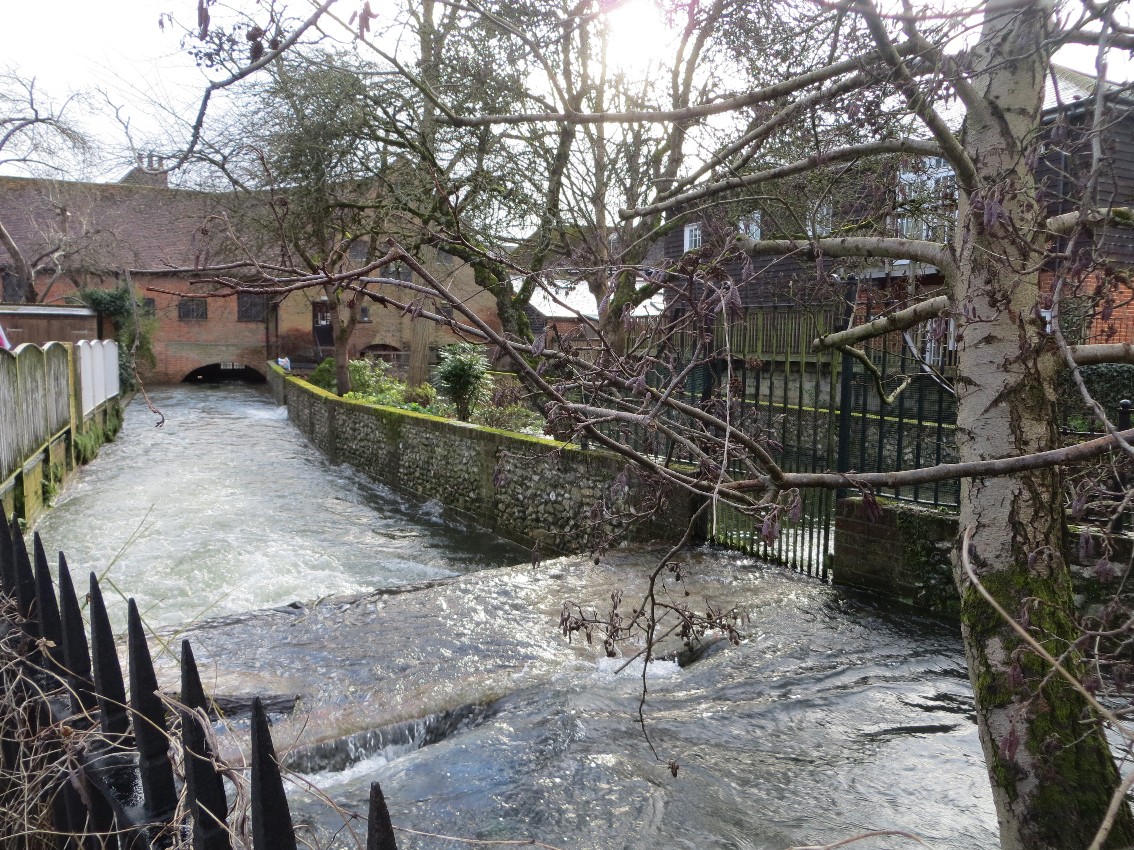
Durngate Sluices, Winchester
Ruth
Andrews
|
|
The River
Itchen is a chalk stream and is fed by groundwater.
During prolonged periods of rainfall the groundwater
levels rise resulting in an increase of the water
level in the river, but this happens fairly slowly;
there are not sudden flash floods like in some parts
of the country. Historically the River Itchen
flooded in 1852, 1903, 1928, 1935, 1947, 2001, and
2014. This did most damage in 2001, but the highest
level of flood water was recorded in 2014.
|
|
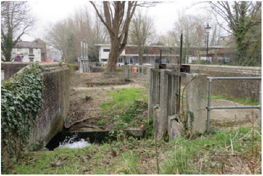
The river’s
flow through Winchester is restricted by the sluices
at Durngate, City Mill, and Wharf Mill; all 3 mills
were built across the main channel of the river. In
2014, as seen here at City Mill, emergency measures
were put in place, but it was obvious that a
long-term solution was needed.
Upstream of
Durngate sluices there is an extensive flood plain,
historically occupied by water meadows. It was
decided that this land would make a suitable
overspill area, which would require minimal work to
hold back the water.
|
 |
|
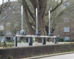
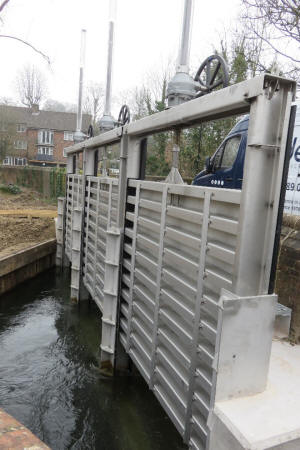
North
Winchester Flood Water management Scheme was funded
by Hampshire County Council, Winchester City
Council, the Environment Agency, and Southampton
University. Phase 1 implemented in 2016 involved
the construction of brick walls with rising barriers
in the gaps and strategic earthworks.
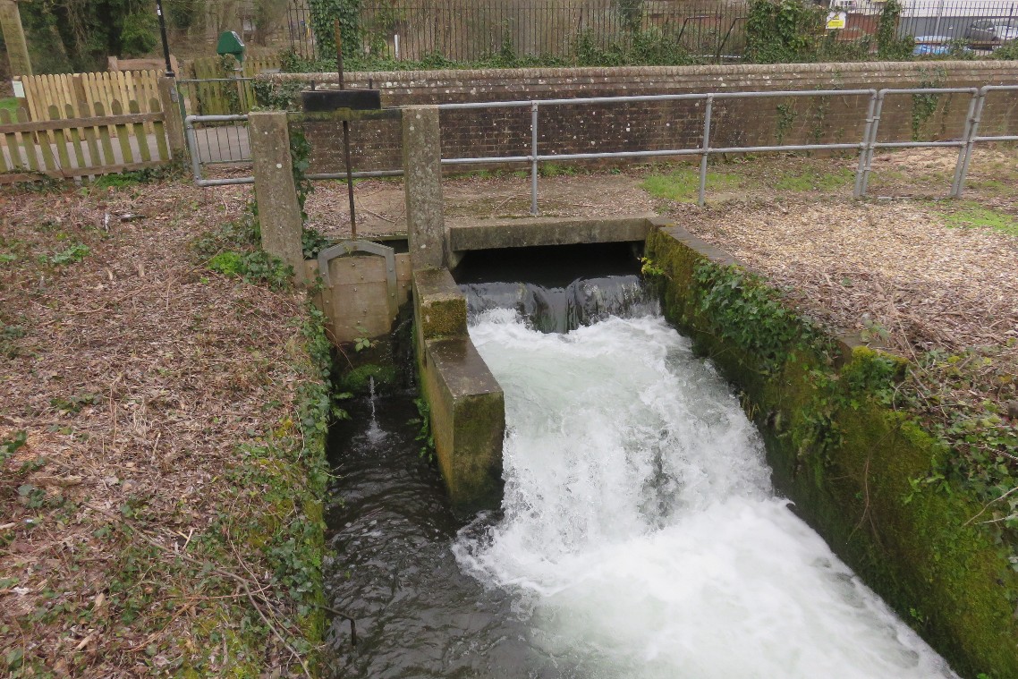
Phase 2 in
2019 provided three new sluice gates on the
remaining uncontrolled channels of the River Itchen.
The sluice gates are adjustable so they can help to
manage the flow of river water – the gates will be
able to hold back up to 250,000 m3 of
water, equivalent to around 3.2 million bathtubs of
water (how many double-decker buses is that?).
|
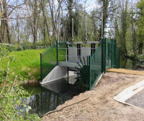 |
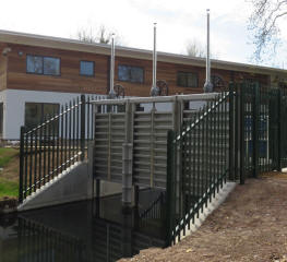
New Sluices,
left to right 1, 2, 3 |
 |
|
Two of the
gates are located either side of Durngate car park
(1 and 2 on the map) with the third (3) between the
road and pedestrian bridge at the entrance to
Winnall Moors. So if they are closed because of
rising water levels, Winnall Moors NNR will be
inundated.
|
 |
 |
|
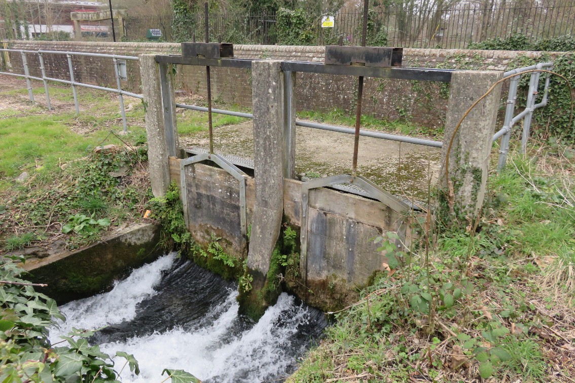
Unfortunately the existing sluices at the Durngate
Mill site, a single sluice (A) and a double sluice
(B) across the divided main river flow, have not
been replaced and look to be in poor condition.
|
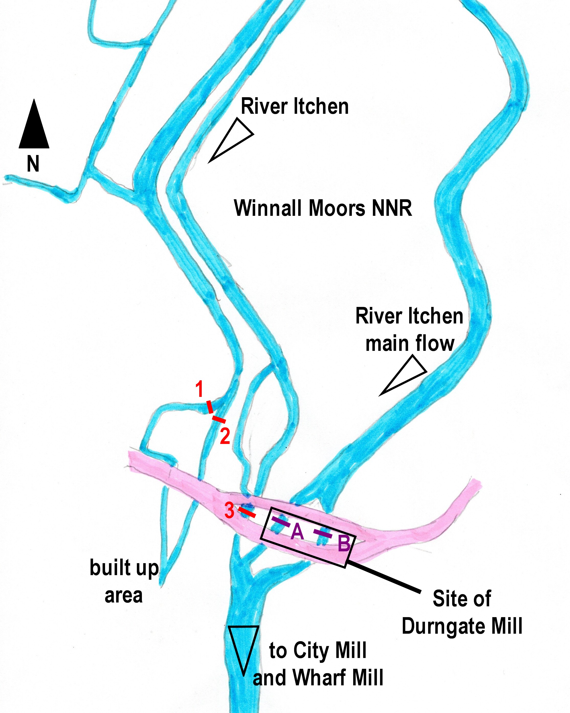 |
Site of Durngate Mill showing old sluices
(foreground)
and new sluice 3 in the distance and right |
 |
|
A note about Durngate Mill
Just before
the mill was demolished in 1966, it was surveyed by
members of the Winchester Model and Engineering
Society, J Reynolds, C Burrell, and D Bignell. It
is well worth reading their detailed report and
accompanying diagrams, which can be found
here.
The mill
straddled the main stream of the River Itchen. The
river divided immediately above the mill, forming
two separate races which passed below the floor to
unite again at the southern end of the garden. Each
branch sub-divided within the building to form a
head race and a by-pass, each with its own sluice
gate operated by rack and pinion gearing.
|
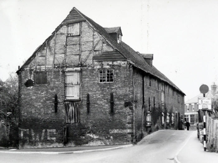
Durngate Mill in 1966, shortly before it was demolished,
viewed from the east side.
John Reynolds |
|
|